***PAGE UNDER ACTIVE DEVELOPMENT***
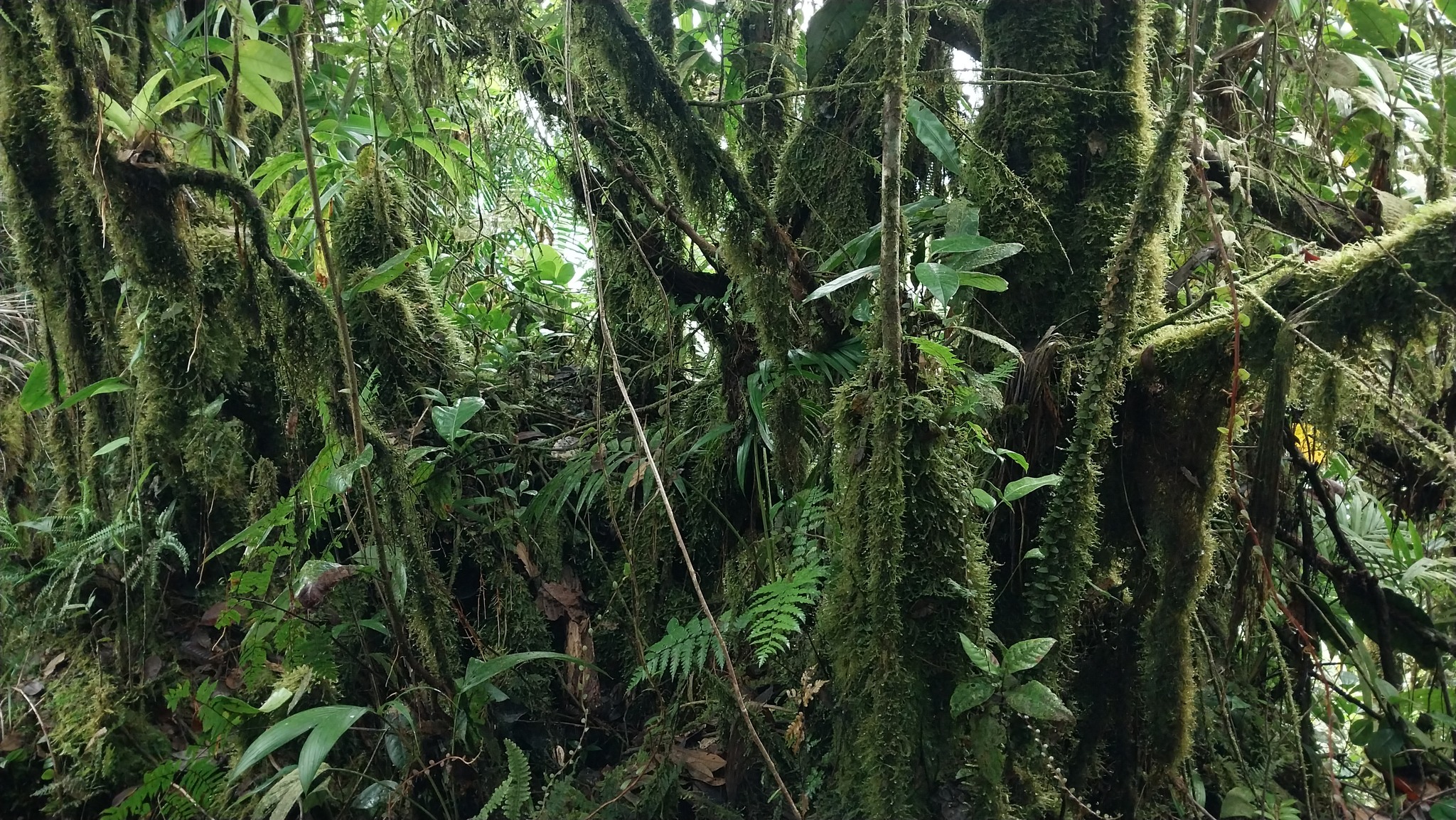
Among the primary reasons for conservation of the island’s forests is for the conservation of water. Given the volcanic origin of the island, the underlying geologic formations, combined with the generally steep terrain, ground water reserves are very limited. Hence, the drinking water supply for the country and water used for other purposes such as irrigation for agriculture is derived almost entirely from ‘surface sources’; streams and rivers. The largest rivers on the island originate in the high-elevation forested interior, although several smaller rivers have their headwaters at lower elevations.
The forest serves to retain rainfall that falls on the land surface, where the tree root networks and the organic matter that forms part of the forest floor, together acts like a sponge that retains moisture, and releases it in a controlled and steady manner into the sub-surface of the soil and rock, that emerges as mountain springs which flows into streams and rivers, eventually draining into the sea.
As far back as the mid to late 1800s, with the destructive impacts of wanton forest clearing for agriculture, timber and fuelwood extraction becoming obvious, the colonial government at the time commissioned investigations into the state of the island’s forests to come up with recommendations for conservation. It was a great concern that continued trends in deforestation would spell loss of the ability of the forests to yield water needed to support health and sanitation of the growing communities.
In 1887, E.D.M. Hooper of the Indian Forest Department was commissioned to do such an investigation. In his Report upon the Forests of St. Lucia he recommended that there be no more clearing of forest lands on Crown (government-owned) lands, and that boundaries of forested lands be clearly marked. He also recommended that a forest warden be appointed to manage the forest resources of the island.
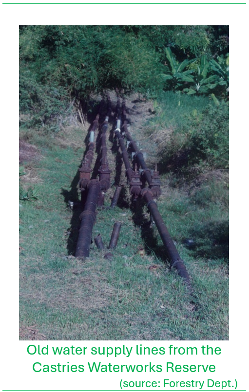
Taking on board recommendations from the Hooper report and to allay the threat deforestation posed to the most important water supply area to the city of Castries, in 1916 the colonial government declared some 1,393 hectares (3,442 acres) of the expansive forests between La Sorciere and Piton Flore (that were on Crown lands) as the Castries Waterworks Reserve, in accordance with Section 4 of the Castries Water Supply Ordinance (Chapter 230) of 1901 relating to designating and protecting ‘Gathering Grounds‘ for water. In those days, small water intakes were established on select forest streams at Des Chassin and at Forestiere, that fed water to the city mainly via gravity.
In 1946 the Forest, Soil and Water Conservation Ordinance (‘Act’ since 1983 amendment) was passed into law; the naming of the legislation underscoring the importance of the inseparable link between conserving water resources through the conservation of forests. In that same year, other forest reserve areas were established, specifically the Dennery Waterworks Reserve and the Quilesse Reserve.
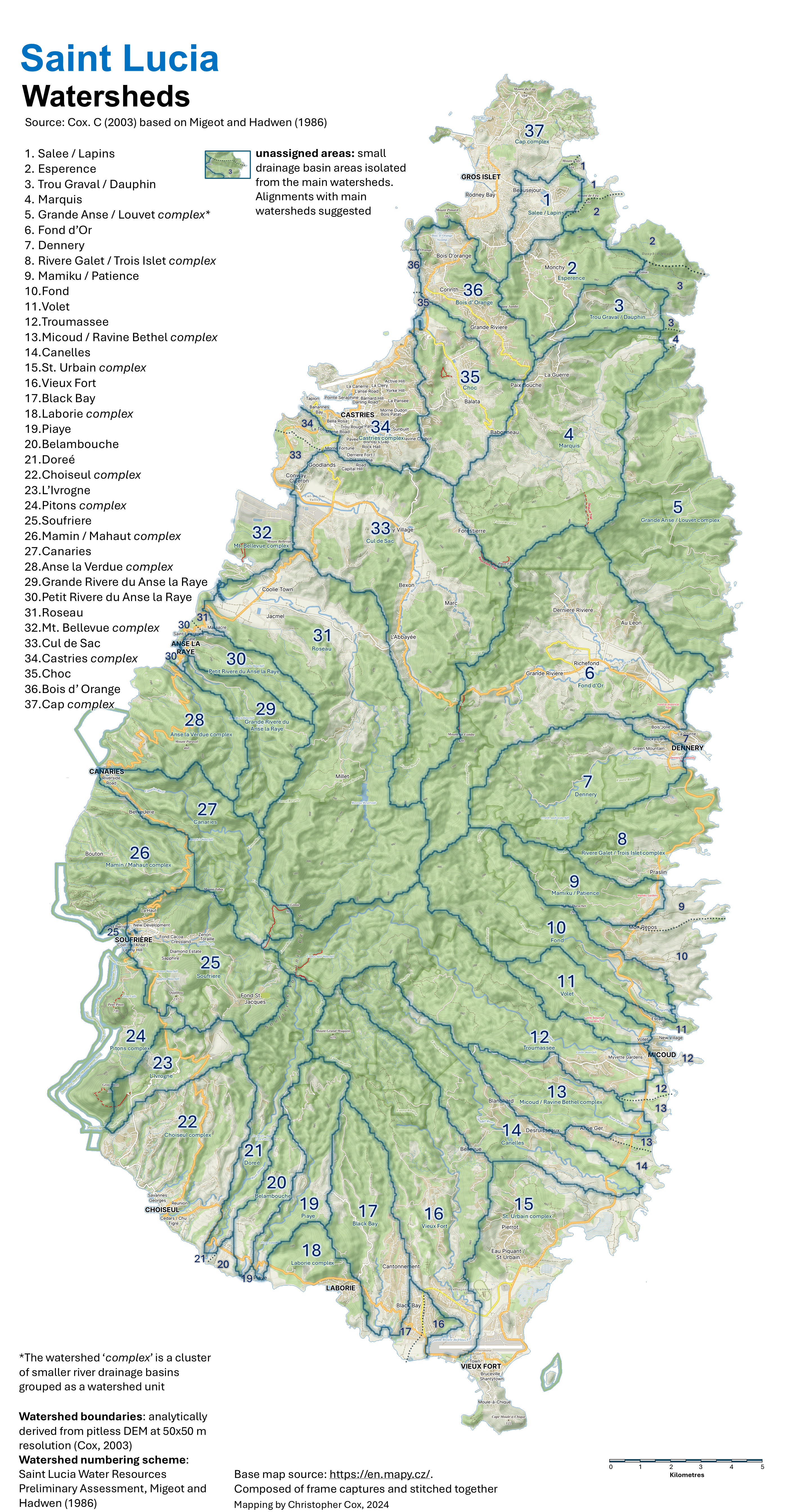
Saint Lucia’s watersheds
Saint Lucia’s 616 km2 landscape, has been divided into 37 main watersheds based on the geography of its river networks (based on work of Migeot, J. & Hadwen, Saint Lucia Water Resources: Preliminary Assessment. Vols. 1 & 2. Ministry of Agriculture, Castries, St. Lucia. 1984).
A watershed is an area of land that drains all the streams and rainfall to a common outlet such as the outflow of a reservoir, mouth of a bay, or any point along a stream channel. The word “watershed” is sometimes used interchangeably with drainage basin or catchment. Ridges and hills that separate two watersheds are called the drainage divide. Source: US Geological Survey.
The size and the shape of the watershed depends on the terrain of the land, how the mountain ranges are arranged across the landscape; this in turn dictates how expansive the network of the river and its tributaries are within the watershed.
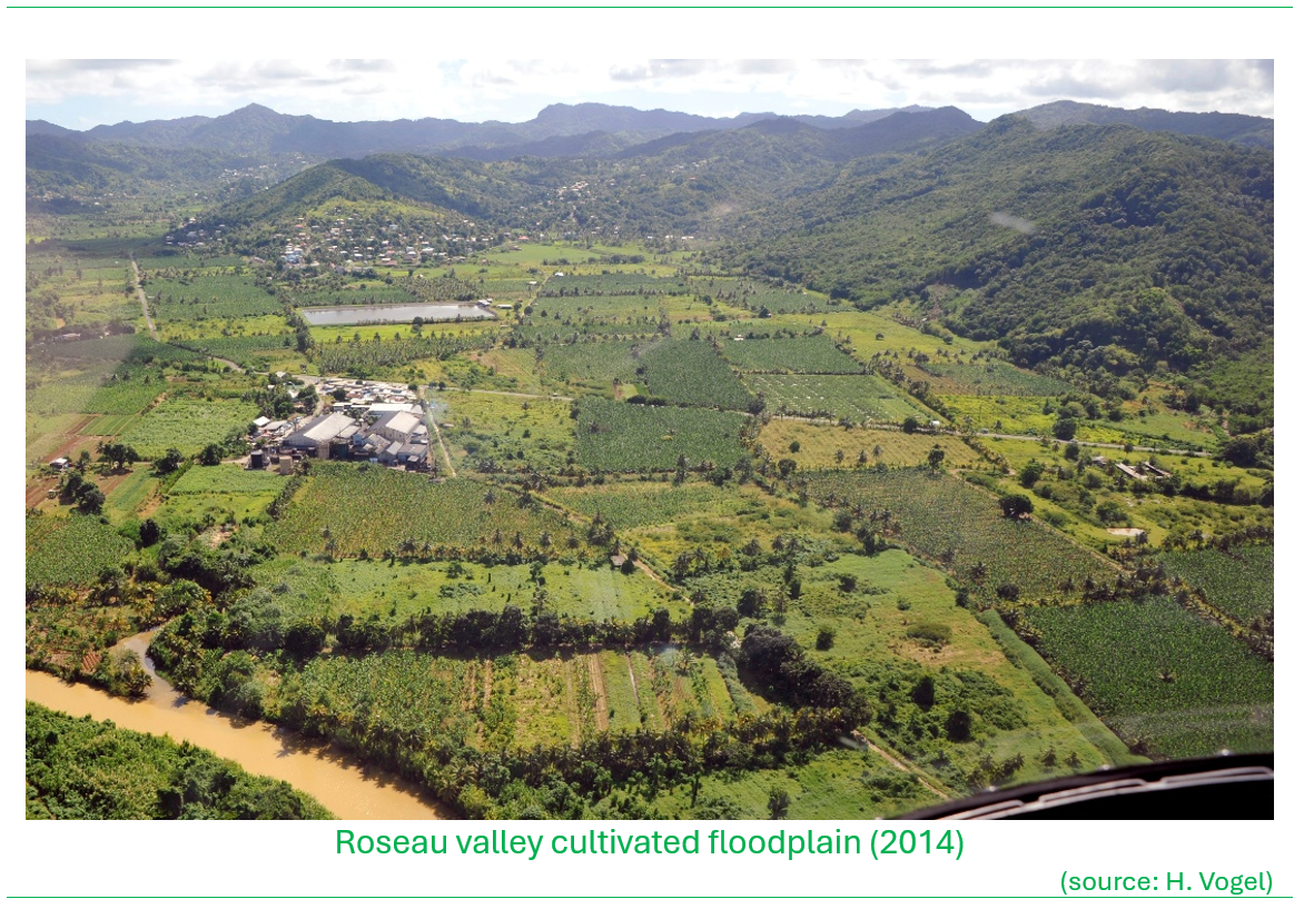
Rivers like the Cul de Sac, Mabouya, Marquis, Roseau and Troumassee rivers have their ‘headwaters’ or sources (springs) within the deepest, high-elevation forested interior and have extensive networks of smaller streams that feed into the main river within relatively broad watershed areas. The fact that these rivers drain larger areas means that the flow volumes are higher than smaller rivers that drain smaller watershed areas. These larger rivers not only carry more water, but they also carry more natural sediments, as the upper landscapes naturally erode under rainfall impact.
During vary large storms the lower segments or ‘reaches’ of these rivers flood, spreading sediment over wide areas of the flood plain, gradually creating the characteristic flat valley floors that have come to support intensive cultivation.
Click or tap on the map below for a detailed view
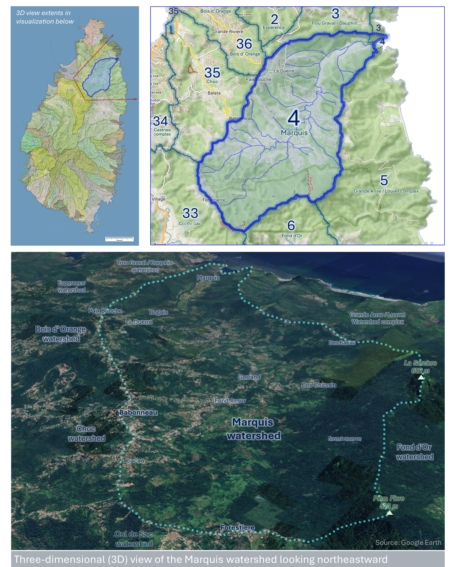
A closer look at one of our watersheds
The Marquis Watershed is the landscape that drains into the Marquis River and its network of tributaries. The Marquis Watershed is located in the northern part of the island where the Marquis River has its headwaters in the elevated ridges from La Sorciere standing at 652 metres westward to Piton Flore at 523 metres and toward the Forestriere area. The watershed (drainage basin) area is 3,059 hectares. The Marqius River eventually drains into the Atlantic Ocean at the Marquis Bay.
The communities of Forestiere, Cacoa, Babonneau, Paix Bouche and Desbarras, along with the connecting road networks straddle the ridgelines or ‘watershed divides’, that separate the Marquis Watershed from the surrounding watersheds.
Click or tap on the image below for a more detailed view
The water cycle
The water cycle describes the continuous ‘cyclical’ movement of water within the Earth and atmosphere. When rain falls over the landscape, a fairly significant amount is returned to the atmosphere by a process called evapotranspiration, a combination of the processes of transpiration and evaporation. Trees transpire water and release it to the air as they pull moisture from the soil through the stems and out via the leaves, in the process of photosynthesis. Over heavily forested areas the volume that is transpired can be very significant, over half of the incoming rainfall.
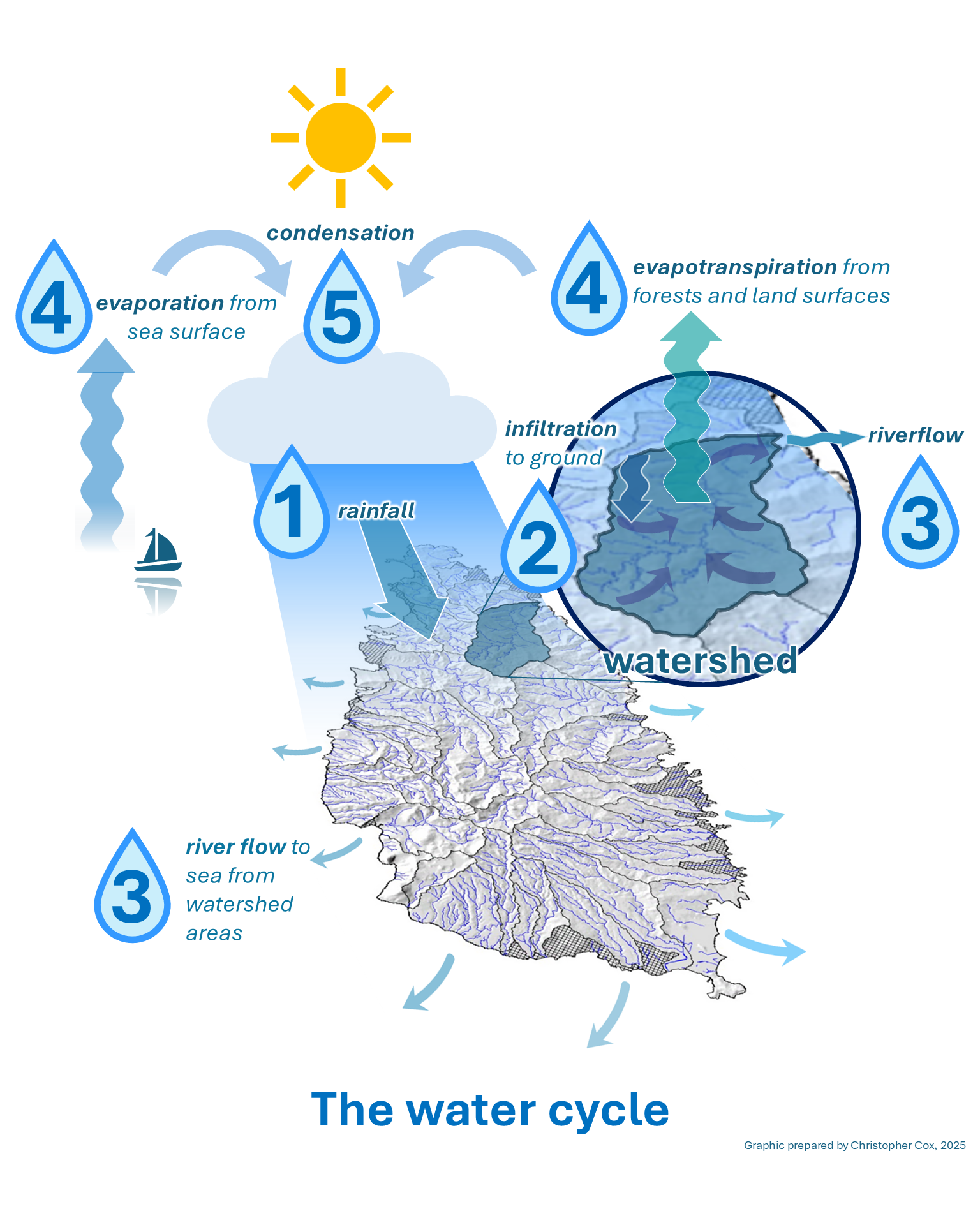
Over non-vegetated areas, water that settles on the surface is quickly evaporated to the atmosphere by incoming solar energy. Of the water that is retained within the landscape, a portion infiltrates into the deeper layers of the soil and bedrock where it contributes to groundwater storage, while the remainder traverses through the upper layers of the soil and bedrock (sub-surface flow), and over the soil surface, to enter streams and rivers generally as surface flow or river flow. This water eventually finds its way to the sea. The graphic illustrates the water or ‘hydrological’ cycle typical for a small island like Saint Lucia.
The water balance: ‘perspective on proportions’
The graphic here illustrates a ‘rough’ water balance for Saint Lucia based on the water cycle. The water balance considers the average annual rainfall across the island, the estimated volume that is lost to evapotranspiration, the remainder that remains on the land surface to flow in rivers. In the case of Saint Lucia, as with similar small mountainous islands in the Eastern Caribbean, the volume of water that is stored as ground water is considered small in relation to the other ‘components’ of the water cycle, although more research is needed to fully ascertain this.
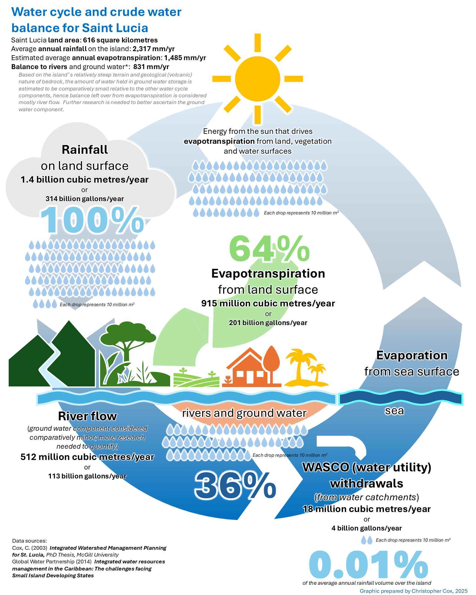
Of the volume that flows in the rivers only a very small amount is abstracted by the Water and Sewerage Company (WASCO) for treatment and distribution as potable water. Click or tap on the graphic for a larger view.
Water use
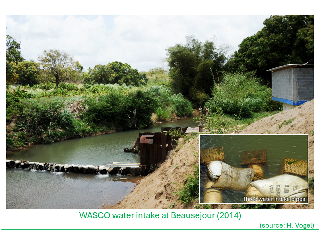
Water taken from our rivers is used for agricultural irrigation, domestic and commercial / industrial use. Extracting water entails the installation of some type of impoundment structure across the flow of the river, with a pump installed to lift the water for conveyance to a storage facility and in the case of drinking water, to a treatment facility and then onward to use. The point of extraction from the river is typically referred to as the intake. The area of upstream land that drains into the intake is known as the water catchment area.
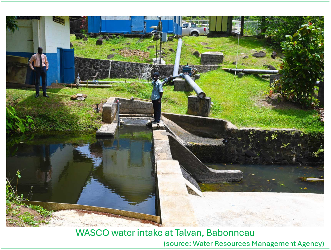
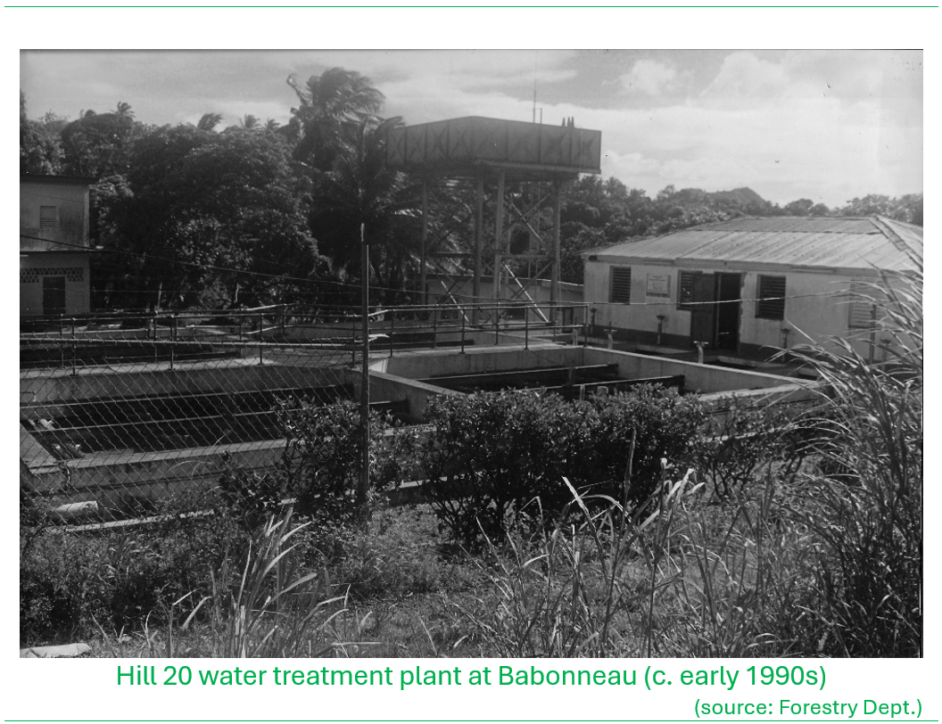
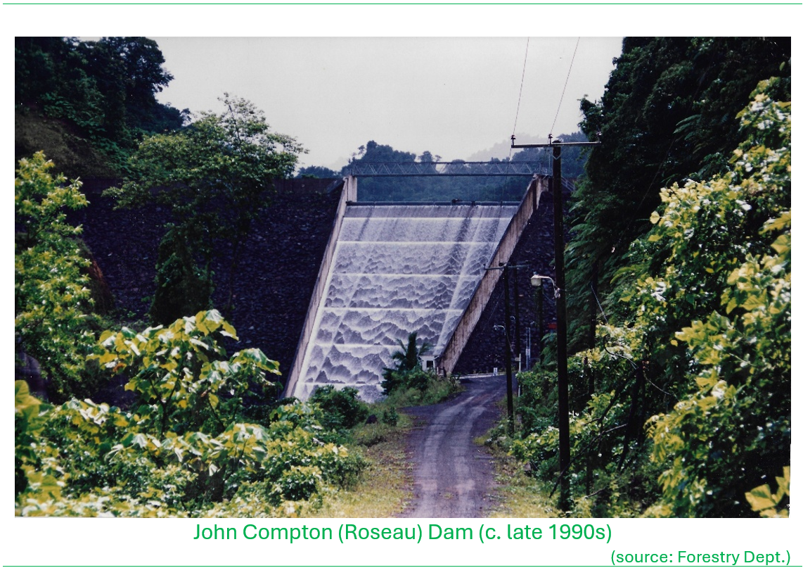
The Water and Sewerage Company (WASCO) extracts ‘raw water’ from some 30 water intakes generally located in the higher elevations of the island, mainly within forested reserve areas. This includes the John Compton (Roseau) Dam. These intakes are operated on a continual basis, however during heavy rains when the streams carry excessive sediment loads as a result of erosion, the intakes, depending on how they are designed, may need to be closed to avoid too much silt entering the water conveyance pipelines and the treatment infrastructure.
During the dry season that lasts from February to May, an additional 8 intakes may be brought into production to augment the water abstractions from the other intakes, when the natural base flows in the rivers decline due to the reduced rainfall.
The problem however with extracting water from intakes situated along the lower reaches of the rivers, which are typically situated outside protective forest reserve areas, is that they are significantly more prone to pollution from the wide range of human activities that may be occurring across the landscape.
Of all the rain that falls on the surface of the island over the course of a year, only a very miniscule amount of that water that infiltrates and ends up in the rivers is extracted for potable water. The vast majority of the water finds its way to the sea.
WASCO’s total water production based on the water abstraction and treatment facilities it operates across the island (at year) averages XXX cubic metres (XXX gallons) per day.
Click or tap on the map below for a detailed view
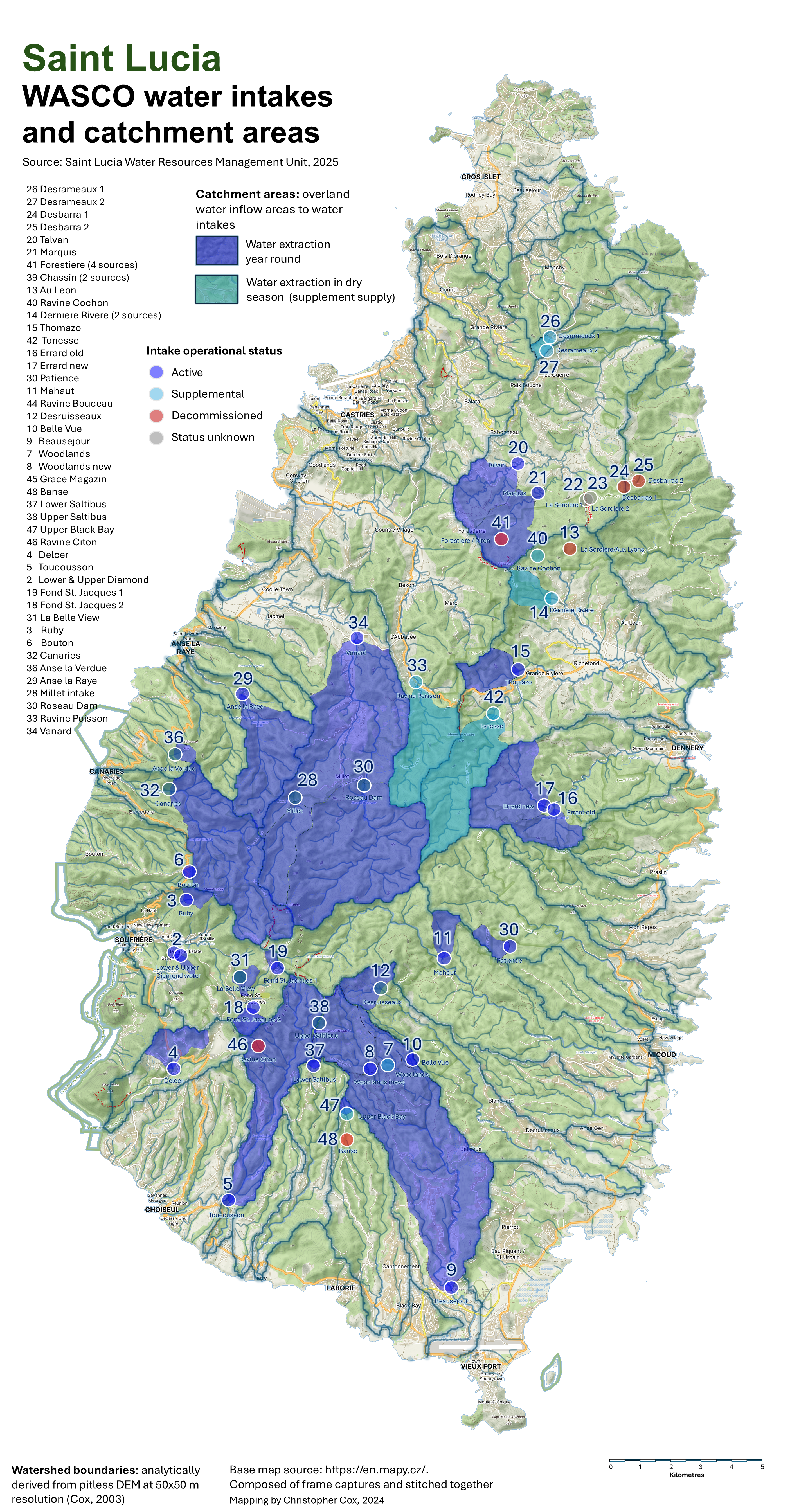
Approximately 19% or 11,800 hectares of the island’s landscape of the island are water catchment areas. Of that, some 4,600 hectares lie within the government forest reserve while the remaining 7,000 ha lie outside of reserve areas; in other words, approximately 60% of the water catchment areas lie outside forest reserve areas ‘unprotected’, on private lands (red areas in the map below).
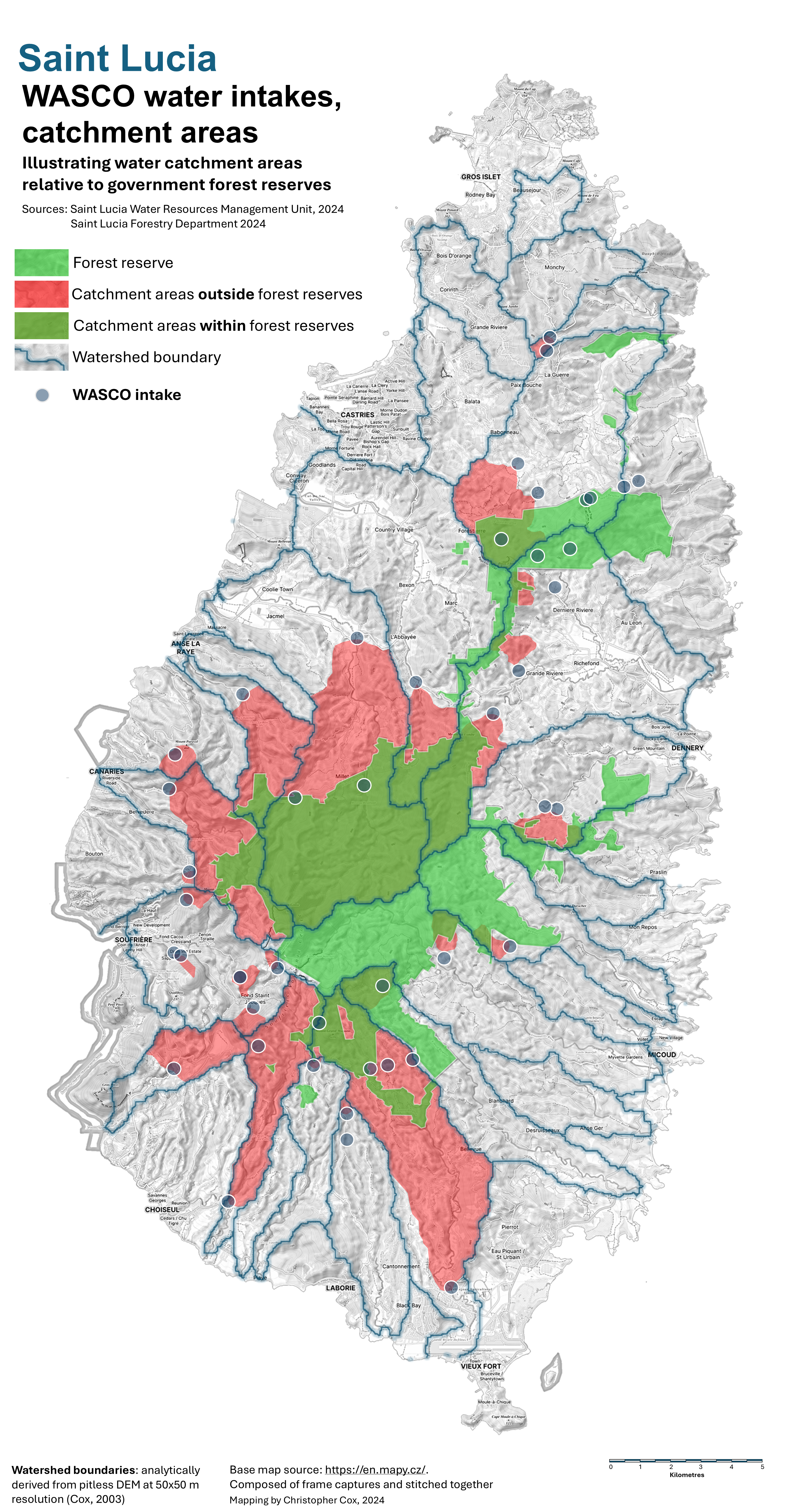
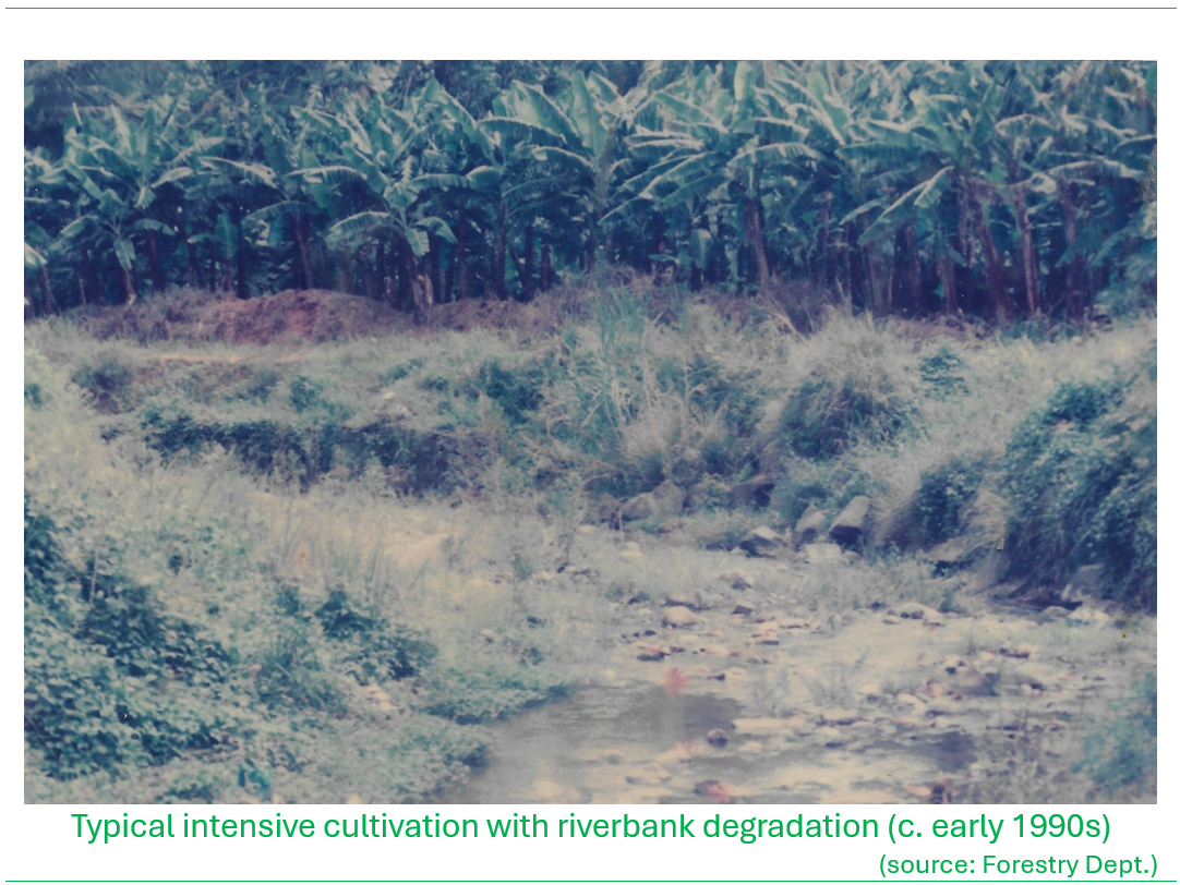
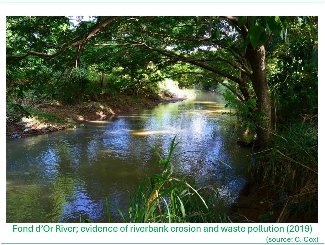
These ‘unprotected’ catchment areas face the potential risk of degradation from human activities. Such activities include crop and livestock agriculture and associated soil erosion, application of excessive and/or harmful agro-chemicals, livestock discharges (liquid and solid), mining and quarrying, solid waste dumping, and degradation resulting from poorly planned residential and commercial development.
The strategy of the government, mandated through the Forestry Department on the basis of the Forest, Soil and Water Conservation Act, follows two main approaches; (1) acquire lands that serve as catchment areas from the landowners and (2) work with landowners to otherwise encourage improved land management through good agriculture practices and sustainable land / watershed management so as to reduce land degradation and pollution upstream of water intakes.
In this case, under Section 21 of the Forest, Soil and Water Conservation Act, any area other than Crown Lands, that is private lands, can be declared Protected Forest. In the case of safeguarding water supply, under Sub-section (d), Protected Forests can be declared for ‘ the maintenance of water supplies in springs, rivers, canals and reservoirs.’ The rules that apply to management of Protected Forests are specified under the Schedule of the Act.
The changing climate, water and forests
In the 2020 report The State of the Caribbean Climate, by Climate Studies Group Mona (Eds.) published by the Caribbean Development Bank, notes that based on trends in rainfall data for the past 100 years (1900-2000) and application of state-of-the-art climate forecast modeling, it is expected that the Caribbean as a whole will gradually dry through to the end of the century, in with an increase in temperatures. The forecasted decline in rainfall and increased temperatures translates to increased likelihood of drought conditions, and with enhanced surface water evaporation it will mean decreasing water availability from rivers and streams.
It is also forecasted that there will be increases in the frequency of heavy rainfall events that in turn would increase flooding occurrence, with rivers carrying higher than normal sediment loads and turbidity that will present challenges for water extraction and treatment. It is already well-known that during times of heavy rain when the rivers become silted, the water company needs to suspend water treatment and distribution resulting in water shortage.
How forests and landscapes are managed is therefore of extreme importance. Where forests are cleared and replaced by other vegetation, buildings, roads and other exposed surfaces without water and soil conservation measures, there is an immediate effect in terms of how water is ‘captured and retained’ and gradually cycle through our rivers. With loss of forests and poor land management, the rain that falls tends to run off much more rapidly, often carrying away vital soil that eventually washes out to the sea. Ultimate this means less water is retained by the vegetation and soil, that would otherwise be available for water supply.
Considering the long-term climate change outlook for the Caribbean and Saint Lucia, means that forest cover must be maintained where currently occurs, and efforts must continue to encourage expansion of forest and vegetation coverage that helps maintain moisture recharge and retention and protect soils from erosion and loss.
The Forestry Department in partnership with the Water Resources Management Agency, the Ministry of Agriculture and other organizations, continue a programme of work with farmers and landowners to support the uptake of good land / watershed management practices in these water catchment areas, as well as along watercourses that are prone to degradation and pollution. [can include some key references or links here]
***write-up in progress; come back later***

Christopher Cox (lead author), Forestry Officer, Saint Lucia Forestry Department, 1985-2002

Jason Ernest, Director, Saint Lucia Water Resources Management Agency, 20xx-present