The total area under Government Forest Reserve is 8,028 hectares (19,838 acres), constituting some 13% of the island’s total land area. The establishment of forest reserves in Saint Lucia dates back to 1916 with the establishment of the Castries Waterworks Forest Reserve, designated under Section 4 of the Castries Water Supply Ordinance (Chapter 230) of 1901 relating to designating ‘Gathering Grounds‘ for water. Since then, the other forest reserves were established, commencing in 1946 with the promulgation of the Forest, Soil and Water Conservation Ordinance of that same year.
An additional 1,295 hectares were added to the forest reserve in 2007 . [what about the Roseau Dam reserve; is this within the 1,295 ha? Is the 1,295 ha within the overall 8,028 ha? Verify the numbers with the Forestry Department].
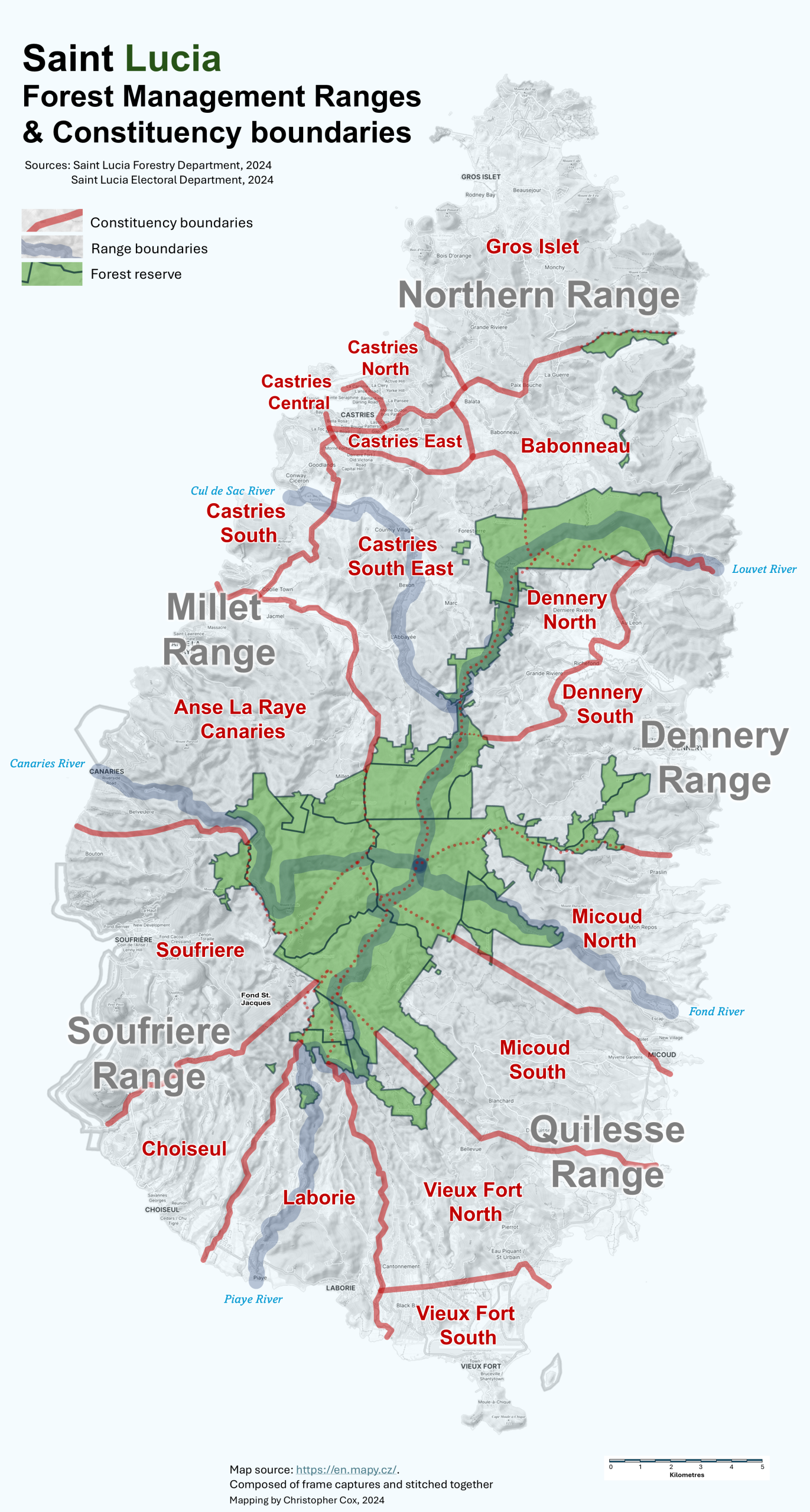
Click or tap on the map to view in high-resolution
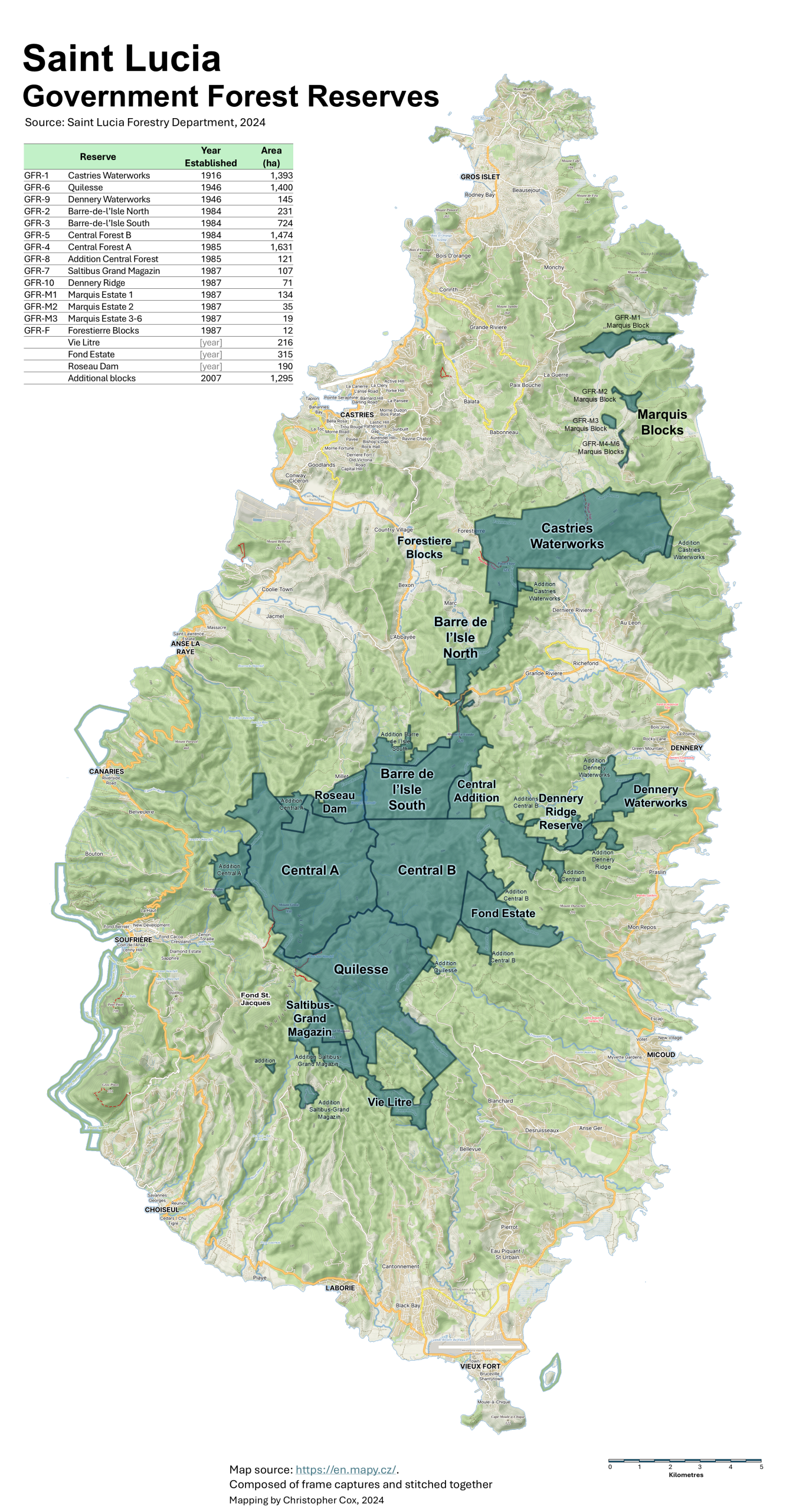
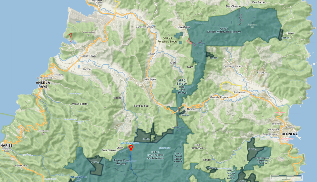
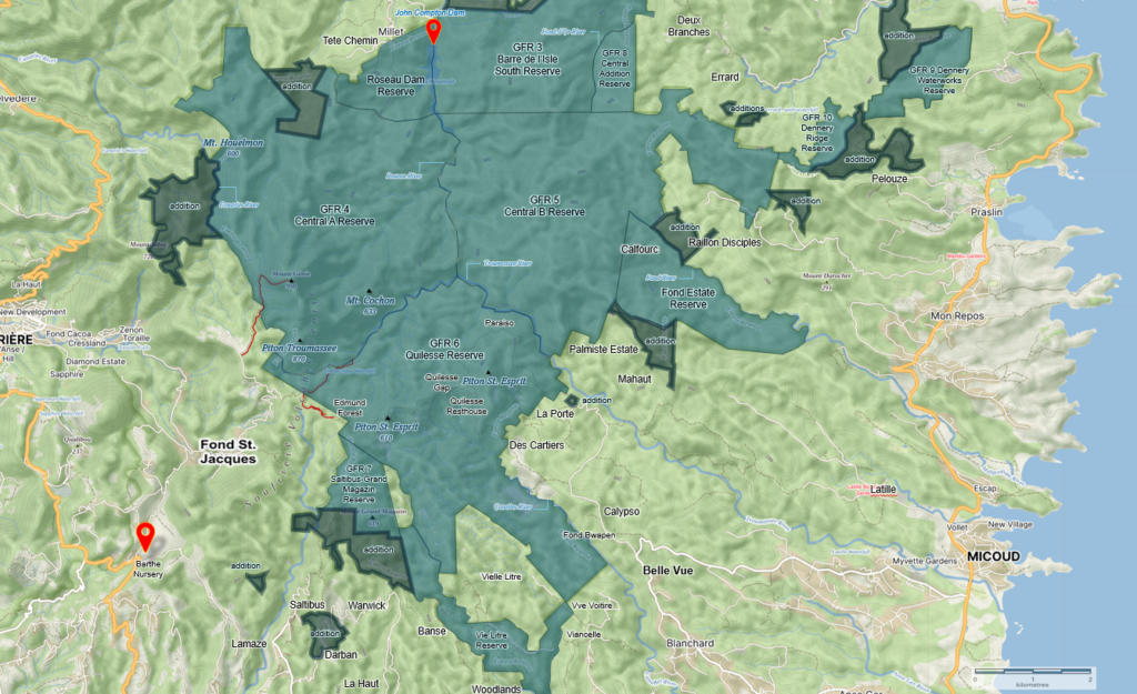
A closer look at each reserve area

Castries Waterworks Reserve
Established: 1916 Area: 1,393 hectares
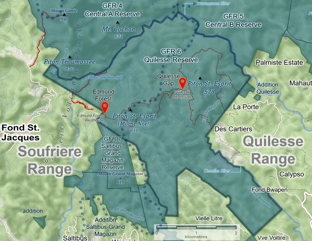
Quilesse Reserve
Established: 1946 Area: 1,400 hectares
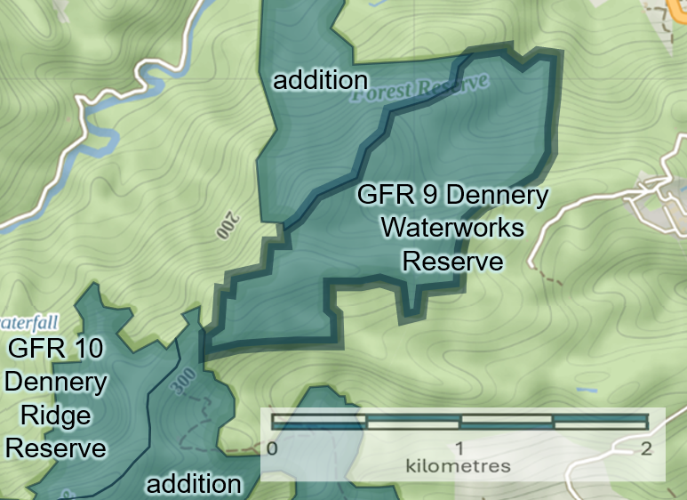
Dennery Waterworks Reserve
Established: 1946 Area: 145 hectares
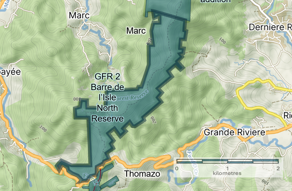
Barre-de-l’Isle North Reserve
Established: 1984 Area: 231 hectares
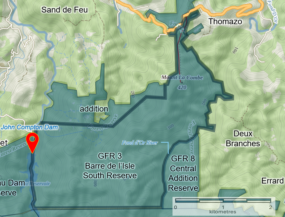
Barre-de-l’Isle South Reserve
Established: 1984 Area: 724 hectares
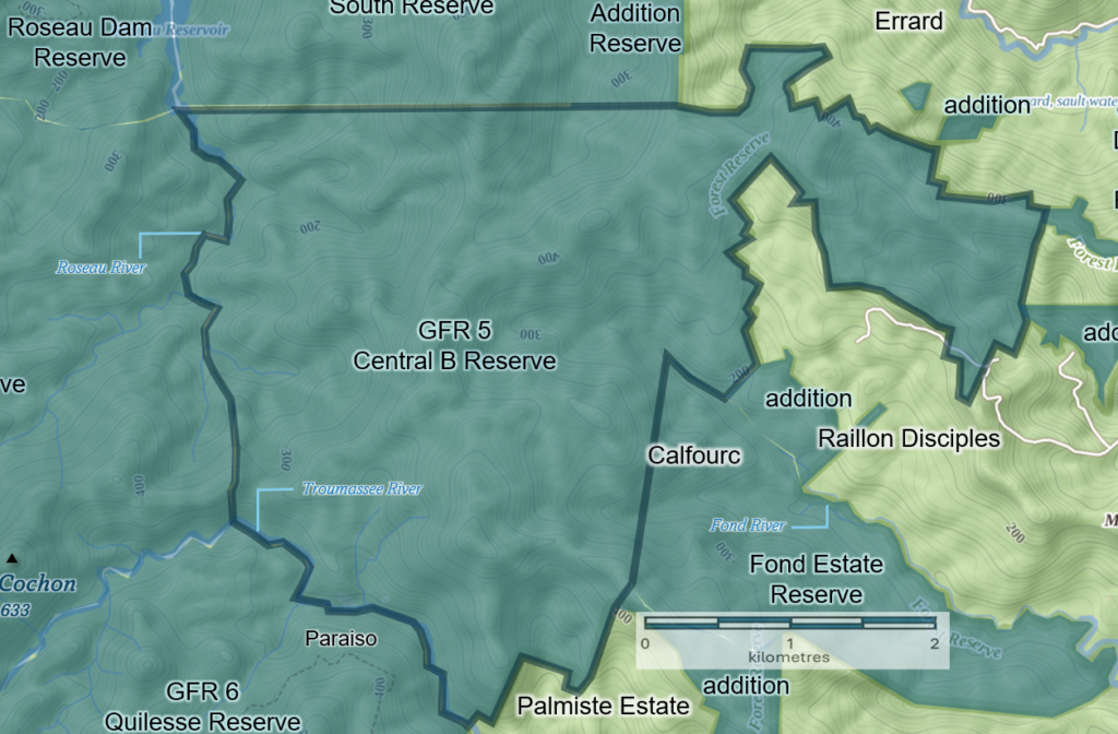
Central Forest B Reserve
Established: 1984 Area: 1,474 hectares
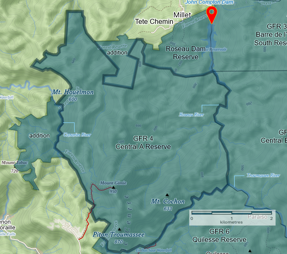
Central Forest A Reserve
Established: 1985 Area: 1,631 hectares

Addition Central Forest Reserve
Established: 1985 Area: 121 hectares
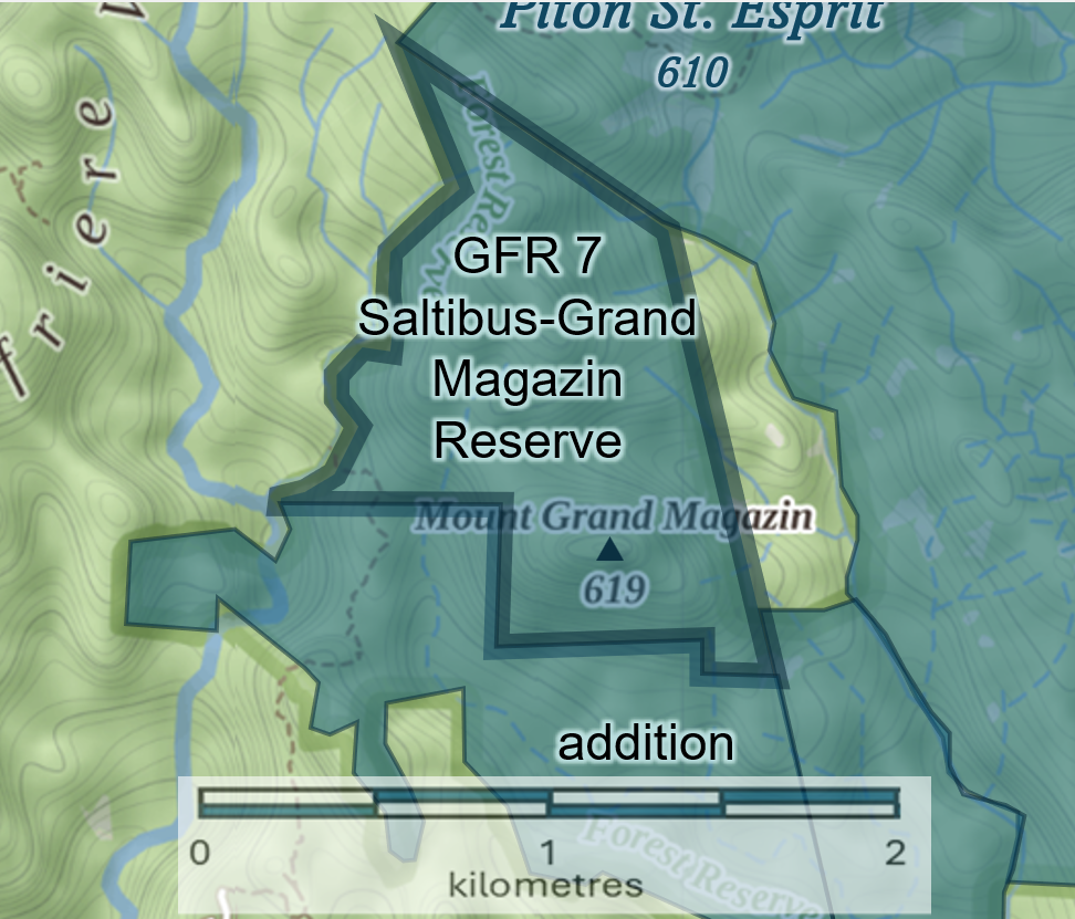
Saltibus Grand Magazin Reserve
Established: 1987 Area: 107 hectares
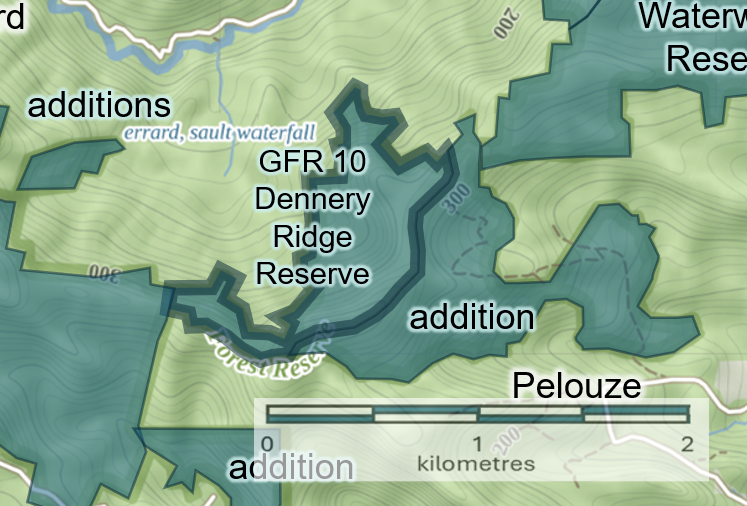
Dennery Ridge Reserve
Established: 1987 Area: 72 hectares
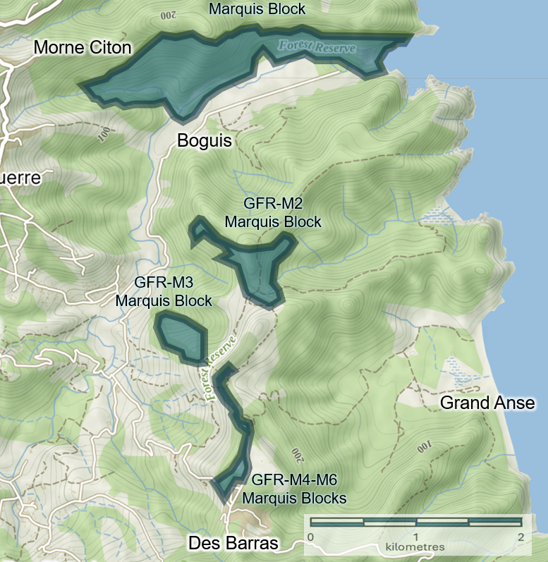
Marquis Estate Blocks
Established: 1987 Area: Block 1: 134 hectares; Block 2: 35 hectares; Blocks 3-6: 19 hectares
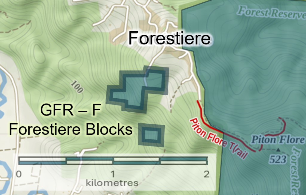
Forestiere Blocks
Established: 1987 Area: 12 hectares

Fond Estate Reserve
Established: [date] Area: 315 hectares
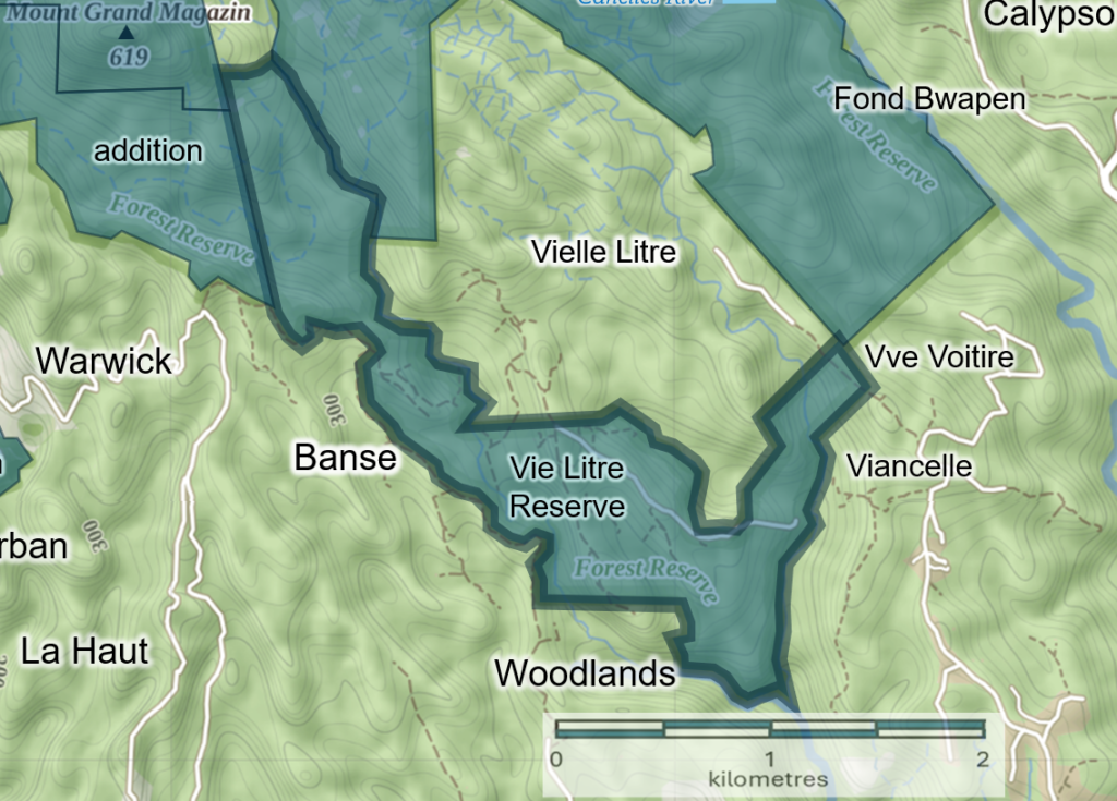
Vie Litre Reserve
Established: [date] Area: 216 hectares
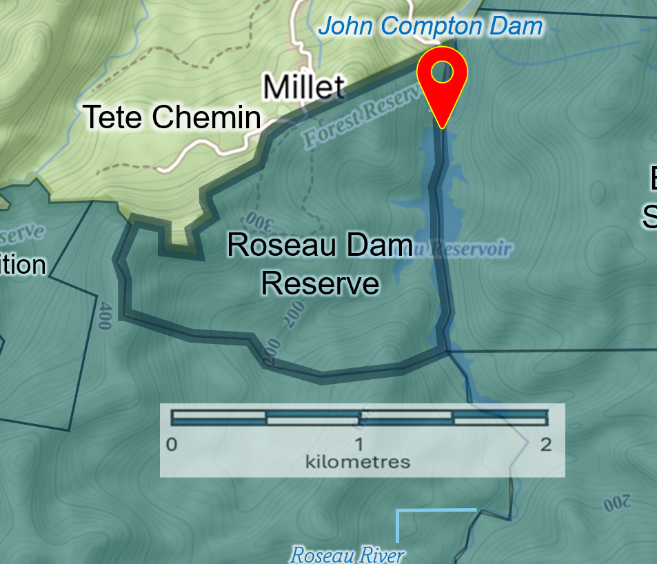
Roseau Dam
Established: [date] Area: 190 hectares
Additions (north) (in dark shade)
Established: 2007 Area: 1,295 hectares total
Additions (south) (in dark shade)
Established: 2007 Area: 1,295 hectares total
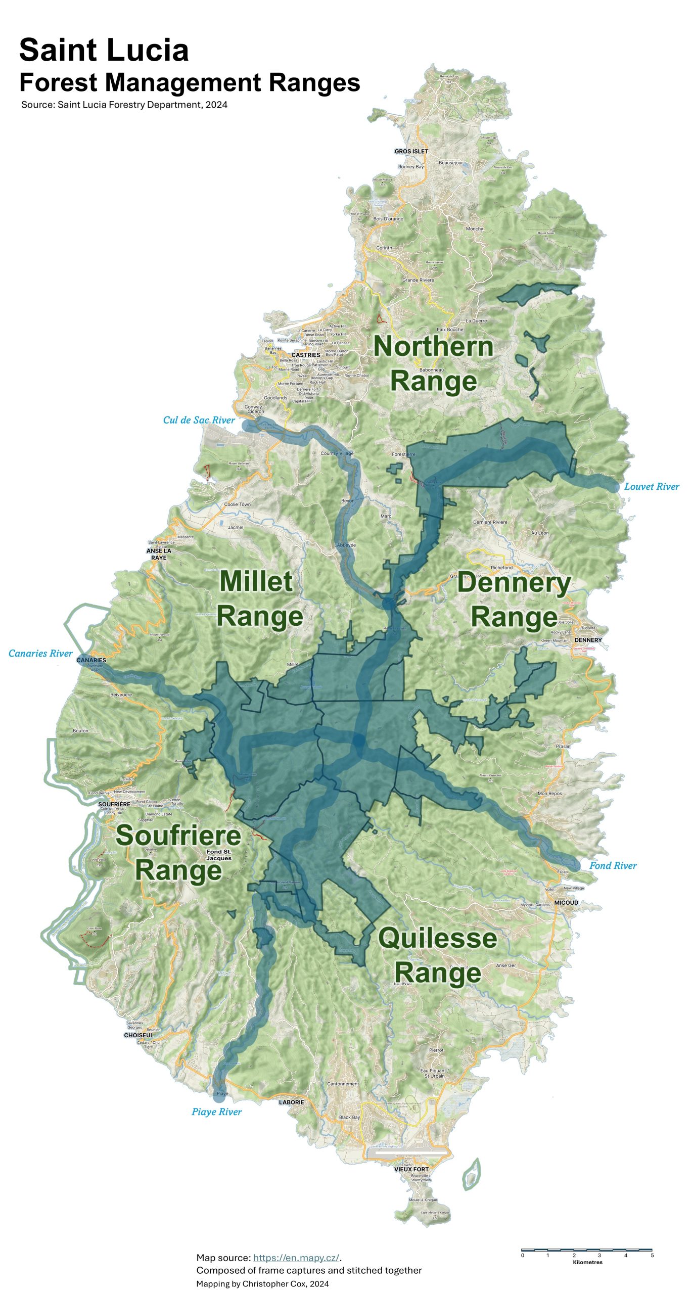
Forest Ranges
The island’s forest reserves and adjacent landscapes, extending all the way to the coast, are divided into five management units or ‘forest ranges’; (1) Northern Range, (2) Dennery Range, (3) Quilesse Range, (4) Soufriere Range and (5) Millet Range. The work of the Forestry Department is organized within these ranges for purposes of monitoring the health of forests, rivers, and wildlife, and for engagaing with communities within each range to help conserve forest and natural resources.

Would love to hear from you! Leave your comments below!